“Walkers are ‘practitioners of the city,’ for the city is made to be walked. A city is a language, a repository of possibilities, and walking is the act of speaking that language, of selecting from those possibilities. Just as language limits what can be said, architecture limits where one can walk, but the walker invents other ways to go.” – Rebecca Solnit, Wanderlust: A History of Walking
A city is not just the buildings and infrastructure but the people and its essence; the nature of the people defines the character of cities. You can feel the city’s charm as you navigate through it and, from the architecture to the people.
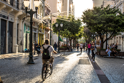
Some of the most charming cities are those you can interact with easily, cities you can cycle and walk around, cities you can feel the wind on your face as you admire their beautiful sights.
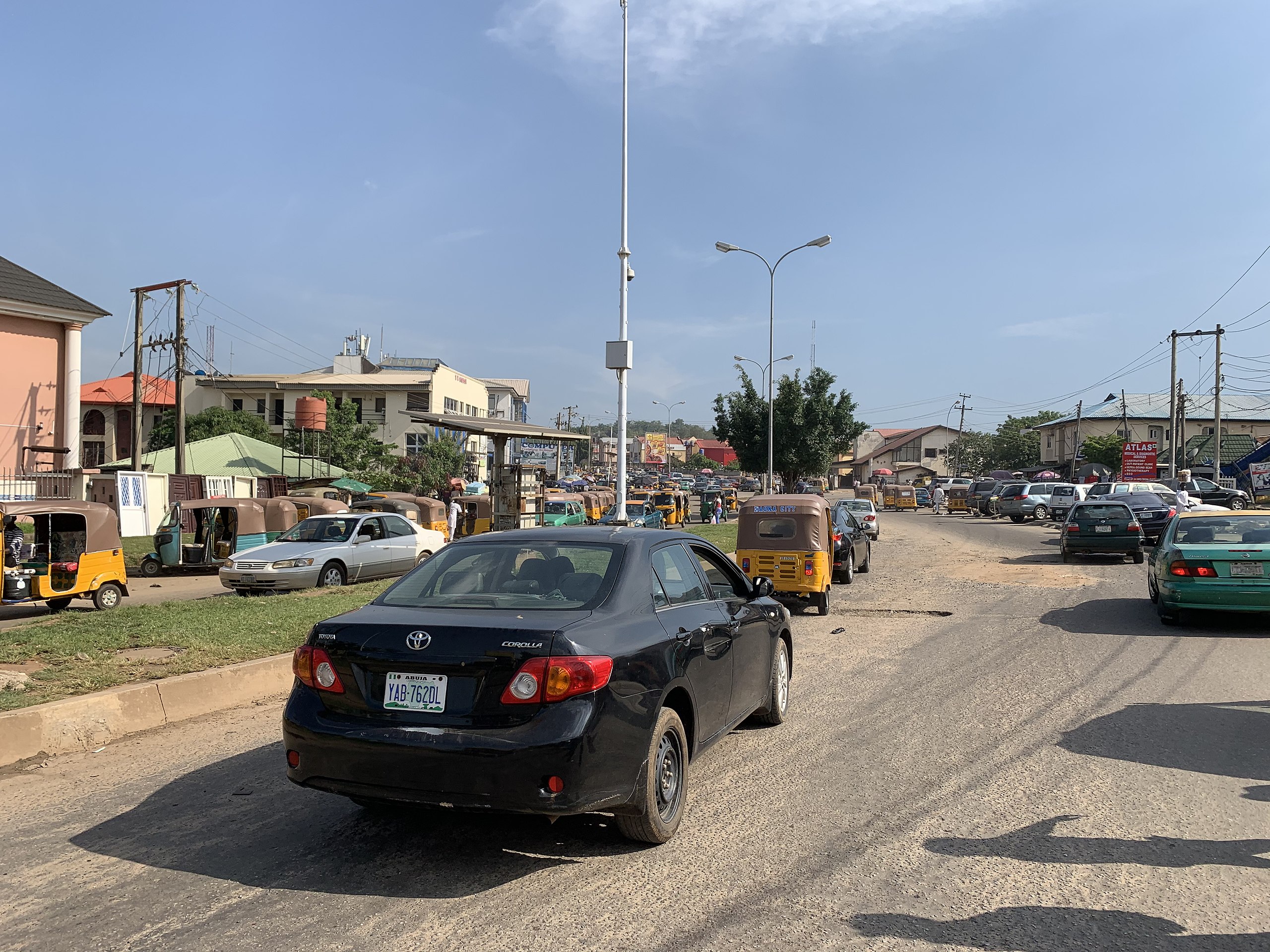
Many charming cities are centuries old and were pedestrian first, so the allure still exists. However, new cities do not have this luxury, especially created ones like Abuja, Nigeria’s capital city. Before new cities are built – A master plan is drawn, places are zoned, and infrastructure is developed; people are then supposed to move into the city and abide by its rules without being part of its inception or development.
International Planning Associates, a consortium of three firms designed the Abuja Master Plan. The consortium was made up of Wallace, Roberts, McHarg & Todd (WRMT – a group of architects) as the lead, Archisystems International (a subsidiary of the Howard Hughes Corporation), and Planning Research Corporation. They brought with them Americans’ penchant for putting the car first in urban design.
Abuja was planned based on a neighbourhood unit concept to provide primary services within neighbourhoods that combined to form districts, which further formed sectors functioning as autonomous mini-cities. However, the neighbourhoods were designed and developed in a car-centric manner. The design resulted in high vehicle dependency requiring the urban population to own or use a car to interact with the city. The plan inadvertently demoted pedestrians and excluded social groups such as the poor, disabled, aged, and children.
A drive towards walkability
Pedestrianisation (making a city more walkable and demoting the car) is not a new concept in urban planning theory or practice. One could say that all cities were once pedestrianised, as urbanisation preceded the popularity of the motor car. Convenient last mile transportation, mass production of automobiles, lowered prices, and more roads made cars the dominant form of transportation in the United States and Europe. The dependence and ownership of cars intensified after World War II, transforming cities through the physical spread of activities and the rise of urban suburbs. Urban researchers, authors, and progressive city managers later discovered that cars and highways that accommodate them resulted in traffic congestion, societal effects, and environmental pollution. Starting in Europe, the adverse effects of car adoption spurred the drive towards walkability through the pedestrianisation of streets all over the world. The most prominent examples are Italy’s Venice, Germany’s Berlin, and, most notably, Denmark’s Copenhagen – where the city’s main street, Strøget, was converted as an experiment.
The pedestrianisation of Strøget was initially met with pushback based on assumptions that the absence of cars was bad for businesses. Overtime, pedestrianisation has proven to be a huge success socially, environmentally, and economically; so much so that a new initiative to pedestrianize an area (larger than Manhattan) in Ringbahn, Germany, was citizen-led.
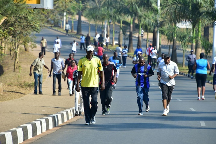
In Africa, where over 60% of trips are made on foot, some cities have made mild attempts to pedestrianise; with Ethiopia, Rwanda and Uganda observing regular car-free days in their capital cities since 2016 as an initiative against air pollution. The focus on walkability has grown from pedestrians who certainly walk at the core to people who are not on the driveway or in a driveable vehicle, such as people on wheelchairs, bicycles, skateboards/roller-skates, scooters, e-bikes, and so on. It encompasses the different purposes and motivations for walking which are mainly for transportation, exercise, and recreation.
Walkable cities are inclusive cities
Inclusive urban planning recognises the value of every urban citizen and grants them equitable physical and socio-economic access to the same levels of opportunities, services, and benefits. It ensures that the (often) marginalised are given their fair rights to the city. Walkable streets extend urban mobility to four main social groups car-centric designs exclude: the poor, disabled, aged, and children.
| Group | Means of Exclusion | Inclusivity of Walkability | Notes |
| Poor | Cannot afford private cars | Reduces car dependency | Nigeria has one of the highest numbers of poor people in one country (World Bank, 2022) and therefore is at high risk of car-dependent exclusion of the poor. |
| Disabled | Wheelchair bound or blind; require help from able-bodied persons. | Improves mobility independence with ramps, tactile paving, non-colour reliant signs, etc. | |
| Aged | Not advised to drive after a certain age, could be wheelchair bound, harsh vehicle noise levels are unfriendly. | Reduces car dependency. Improves mobility independence. Reduces traffic noise. | Gil Penalosa’s “8-80 Cities” concept is based on the belief that if cities are convenient for an 8-year-old and 80-year-old, they are convenient for everyone (see 880cities.org). |
| Children | Not allowed to drive, at higher risk of pedestrian injury and death. | Reduces car dependency. Increases street safety. | Japanese show, Old Enough, where children ages 2-5 are sent on errands alone, gives a glimpse into the walkability of cities for children (Grabar, 2022). |
Examples of pedestrianised cities
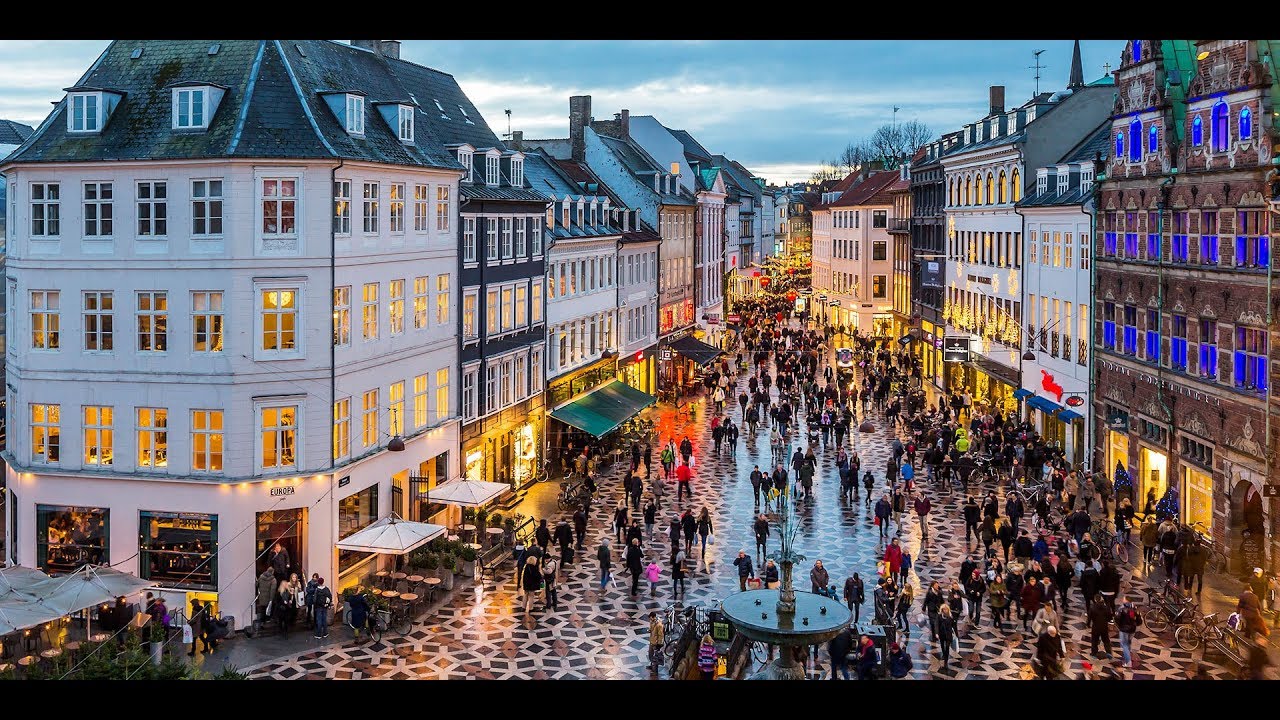
Strøget
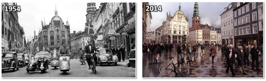
In 1962, Copenhagen’s City Council decided to establish a car-free pedestrian zone from the westerly Town Hall Square toKongens Nytorv (The Kings New Square) in the eastern part of the town called “Strøget”, making Strøget one of the World’s first pedestrianized streets (Copenhagen Portal.dk, 2012).
At the time, the decision sprouted a lot of debates. “Pedestrian streets will never work in Scandinavia” was one theory. “No cars means no customers and no customers means no business,” said local business owners. However, it has become a major success not only for the business owners but the public as well, with the streets now offering Danes the opportunity to develop an outdoor public life they did not have before. The pedestrianization created peaceful, yet lively, public spaces.
The successful pedestrianization of streets in Copenhagen can be attributed, in part, to the incremental nature of change, giving people the time to change their patterns of driving and parking into patterns of cycling and using collective transport to access key destinations in the city—in addition to providing time to develop ways of using this newly available public space (Global Designing Cities Initiative, 2017).
Venice
Venice, Italy, is considered one of the best examples of a pedestrian city because it contains the largest pedestrian street network completely free of cars (New Urbanism, n.d.). The entire city has no cars operating on its streets. Alternative modes of transport in Venice are ferries and boat taxis. Although Venice is a walkable city, it is not the most suitable for cycling due to the irregular cobblestones paving on most of the city’s streets (Mamoli, Michieletto, Bazzani, & Giorgini, 2012). The city is quite dense, yet one of the most relaxing and pleasant cities in the world.

Flower Street (Curitiba, Brazil)
Flower Street gets its moniker from the well-tended flower gardens installed throughout the pedestrian mall (Capello & Buder, 2020). In the Winter of 1972. A group of citizens, led by the architect and mayor Aime Lerner decided to remove the pavement and all the car facilities from the Calle de XV de Novembro (aka Rua das Floras) to take back space from the cars (Curitiba City Planning, 2015). This street is in downtown Curitiba, in the city centre. The initiative was initially strongly criticized and opposed by the shop owners because they felt the loss of cars would result in the loss of customers, but the opposite happened: foot traffic and customers increased drastically (Curitiba City Planning, 2015). This initiative was a great success. There was no legal basis, no special organization, just a general will to change the course of history in the city. It was a citizen-led initiative and a disruption of the top-bottom tradition in urban planning (Curitiba City Planning, 2015). The street was legally pedestrianised in November 1972. To incentivize pedestrians to be the main actors of the city; the government commenced building efficient public transportation.
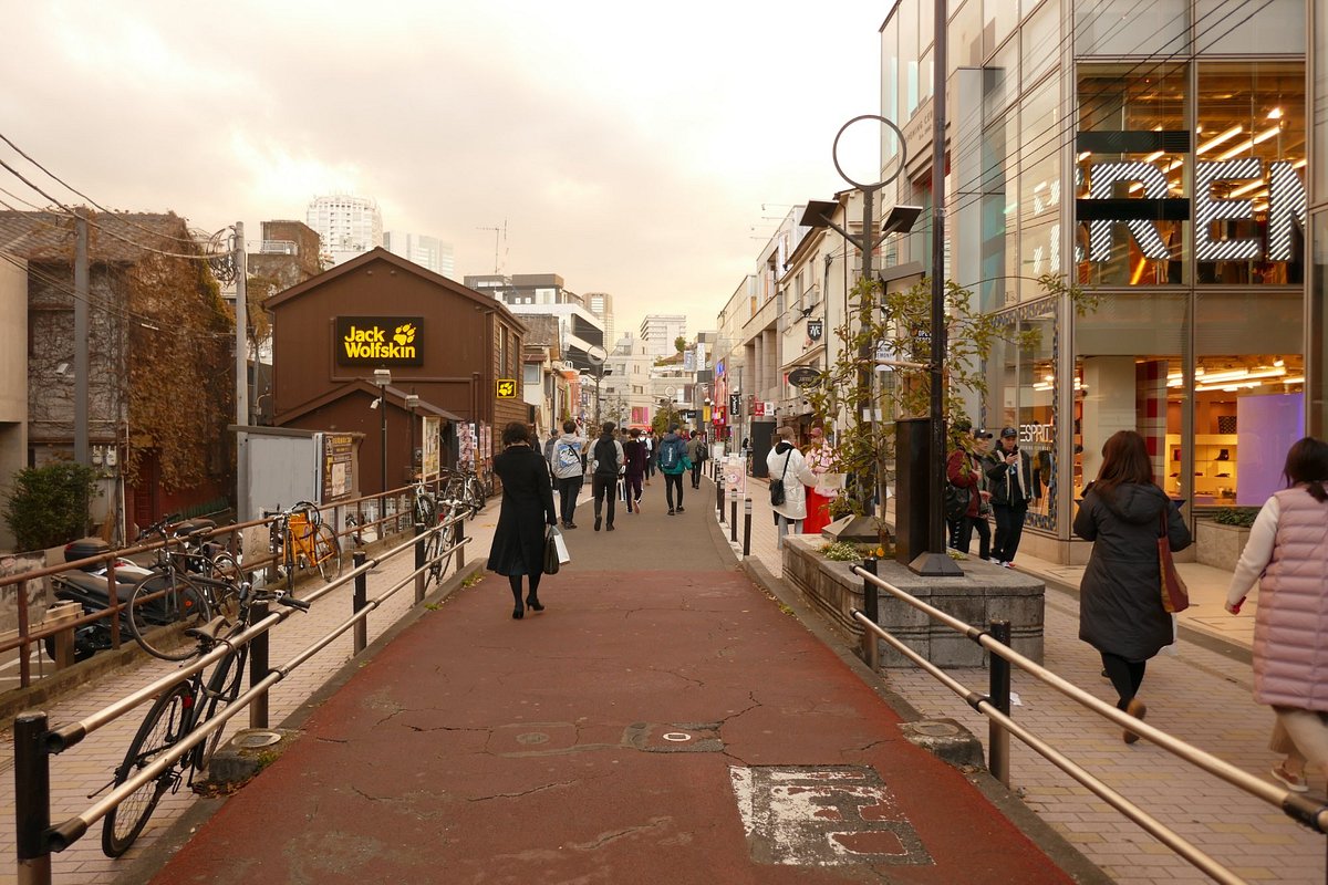
Other good examples of pedestrianised streets include: Buchanan Street (Glasgow, Scotland), Cat Street (Tokyo, Japan), Third Street Promenade (Los Angeles, California) and so much more.
Our solution for Abuja
In deciding what part of the city to pedestrianize, we thought of a few factors. Firstly, we looked for streets with a huge number of pedestrian and vehicular traffic. Secondly, we considered streets with mixed use buildings and finally we looked at popular places in the city where the impact of the intervention would be the most tangible.
We settled on the commercial areas of the city as it ticked all these boxes. It is more sensible to build on existing patterns than to create new ones. The places considered were Area 1 and Area 2 in Garki, then some streets in Wuse 2. We ultimately settled on Wuse 2 because it had more varied traffic and it is the unofficial city centre.
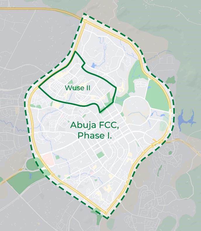
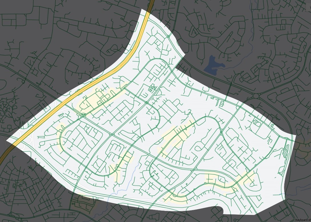
Wuse II, Abuja – the study area
Location
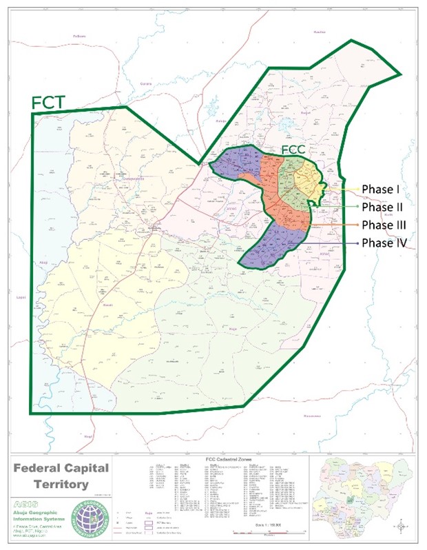
Wuse II is one of six residential districts located in Phase I of the Federal Capital City (FCT). Non-residential districts in the Phase are the Administrative District known as Three Arms Zone and the Central Business District known as Central Area. Wuse II is one of the city’s busiest and most popular districts hosting prominent landmarks like Wuse Market, Sheraton Hotel, Bannex Plaza, Riverplate Park, and a variety of offices and shopping complexes.
Source: Author’s Design after (AGIS, 2010)
and (Google MapStyle,2022)
Land Use Plan and Compactness
Wuse II was planned primarily for residential land uses, mixed land uses along its distributor streets, and commercial and public land uses in neighbourhood centres. However, the popularity of the district has led to a rise in the demand for commercial land use zones as businesses seek to locate their offices and shops therein. As a result, the district has faced a high rate of land use conversions especially along its busier streets, causing real estate agencies to promote it as Abuja’s commercial and leisure centre.
The changing land uses of Wuse II increases the diversity of land uses which fosters walkability by providing a variety of services without the need for inter-district travel.
Circulation Plan and Public Transport
The circulation plan of the roads within the district follows the curvilinear loop pattern which deters walkability by offering long travel distances between points and limiting route choices. This was confirmed by UN-Habitat’s (2013) analysis of streets from forty cities around the world. It classified Abuja among cities with the poorest street connectivity due to very low intersection density despite a relatively higher amount of land allocated to streets.
Source: Author’s Design after (Google MapStyle,2022)
Worse still, like the rest of the Abuja, Wuse II is not currently served by functional public transport. Lot 2 of the Abuja Mass Transit System plan runs through the district but only Lot 3 (from the Central Area to Nnamdi Azikiwe International Airport) out of six lots was once operational, with the rest yet to be developed (Shaibu, 2018). In addition, public buses have ceased to operate in the city after a ban of green painted mini-buses popularly called ‘araba’ in 2013, and the eventual failure of an urban mass transport scheme with metro buses which replaced the araba (Chiedozie, Edeh, & Abolade, 2021).
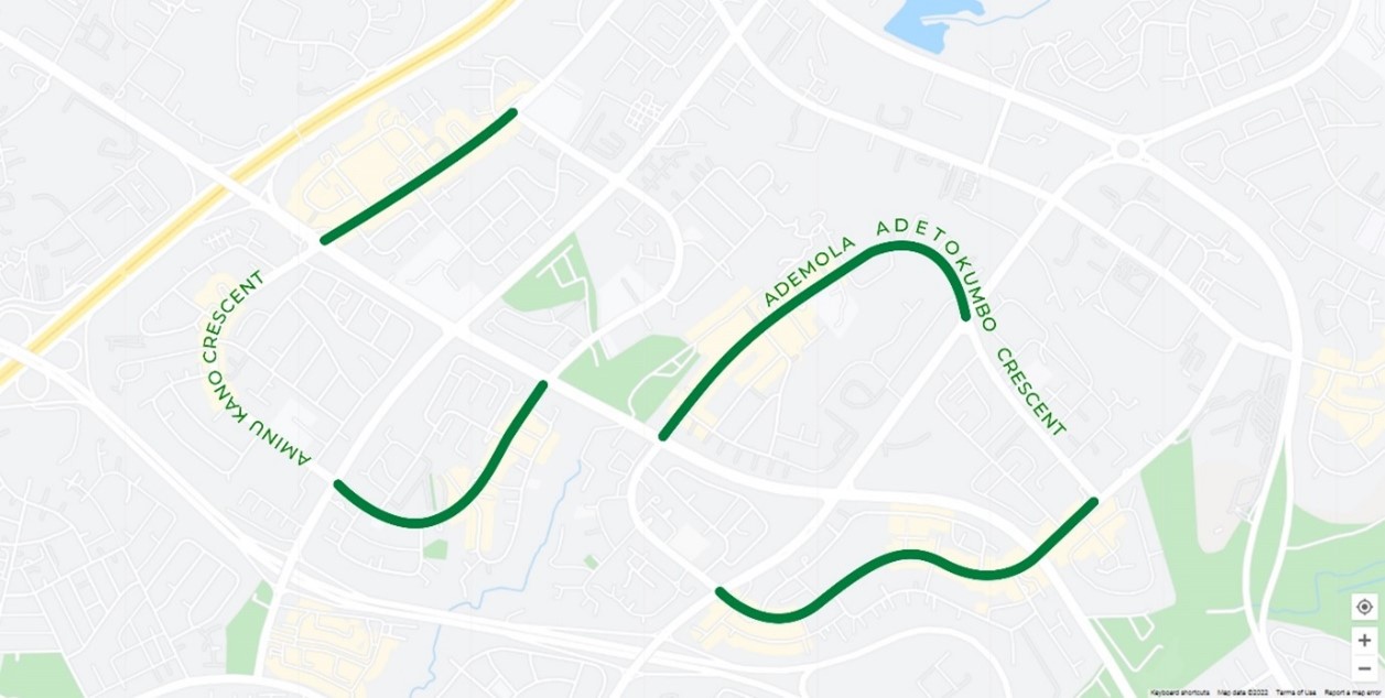
Selected Streets
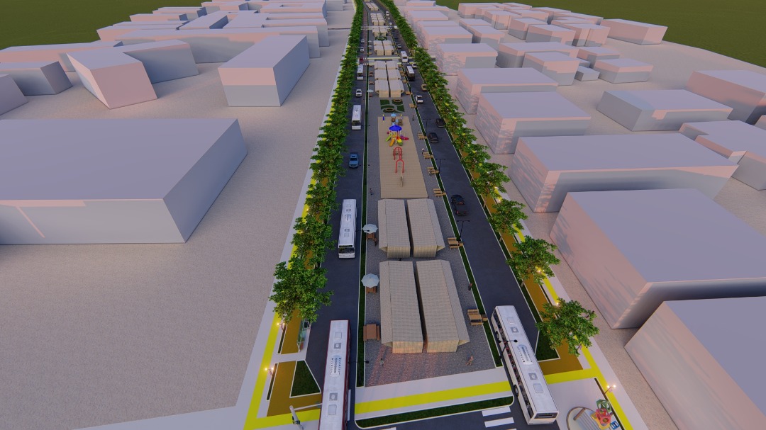
For the design proposal, the two major distributors in the district, Aminu Kano Crescent and Adetokunbo Ademola Crescent, have been selected. The selection was influenced by the significance of the street to mobility in the districts and the nature of flanking land uses. Quadrants of the crescents were selected to allow for entry/exit intersections to/from the newly designed streets, leaving other route choices for through traffic. The street quadrants selected for the design are illustrated in Figure 6.
Source: Author’s Design after (Google MapStyle,2022)
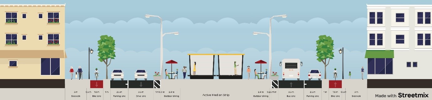
Streetscape
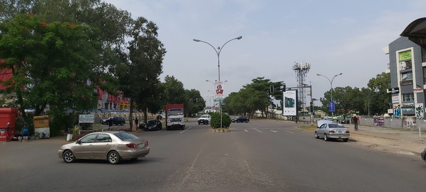
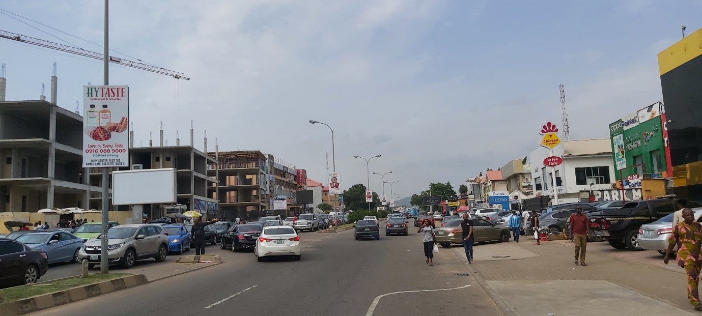
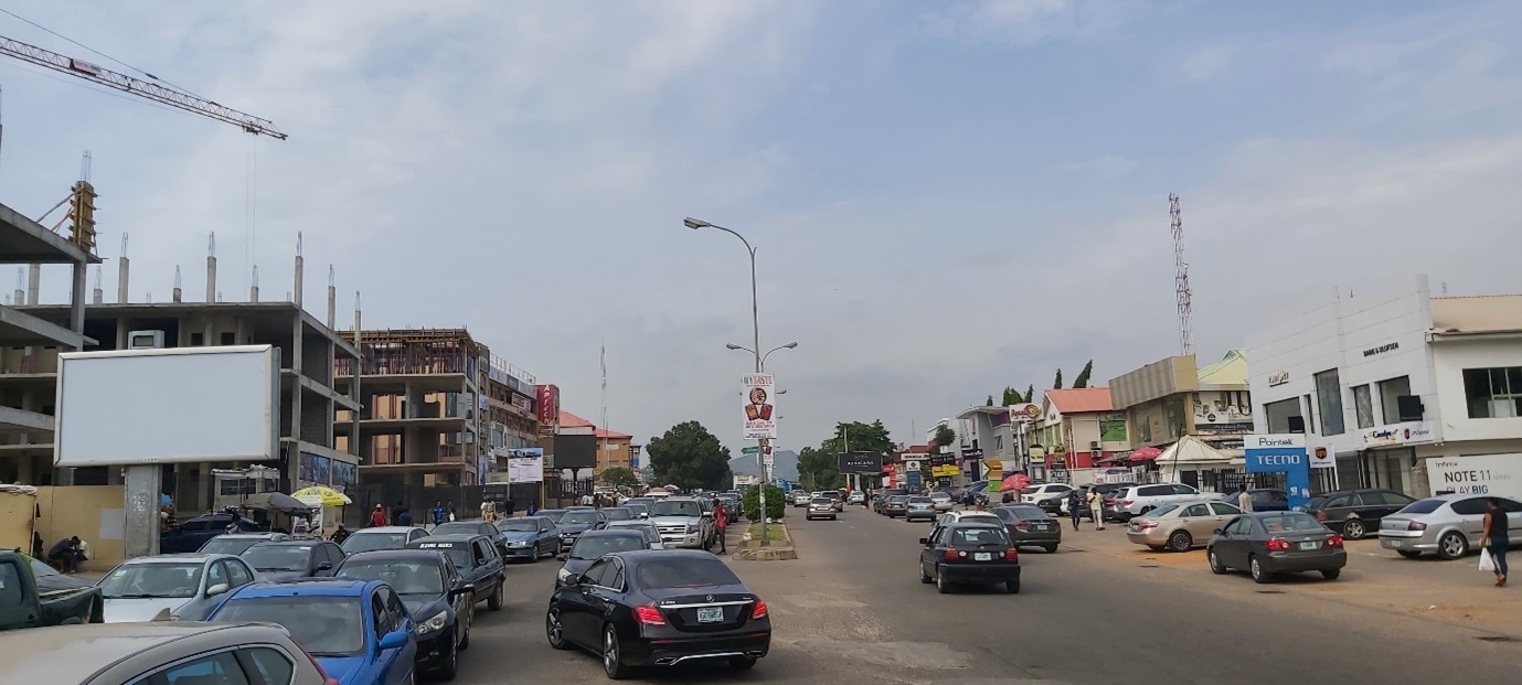
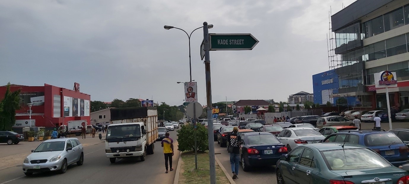
The selected streets have a ROW of 42 metres. On either side of a median strip, the streets comprise of two-lane driveway, a parking lane, a green strip, and sidewalk. Trees and streetlights are distributed along the median strips which improves the streets’ beauty while the sidewalks are unshaded due to sparse tree planting. The sidewalks are also abused by motorists who park their cars haphazardly, especially during the weekdays. No dedicated provision is made for other forms of transport and street markings and signages are non-existent or faded. Plate 1 to Plate 5 show pictorial representation of the character of the streets.
Source: (Field Survey, June, 2022).
Source: (Field Survey, June, 2022).
Source: (Field Survey, June, 2022).
Source: (Field Survey, June, 2022).

Source: (Field Survey, June, 2022).
Street design proposal
The street design is conceptualised to encourage walking while allowing driving for incremental/gentle transition into a pedestrianised street. The cross-section of the proposed street is presented in Figure 7. It comprises of a driveway, parking land, green strip, cycle lane, and sidewalk at both sides of an active median strip.
Source: (Made with Streetmix.net, 2022).
Median Strip
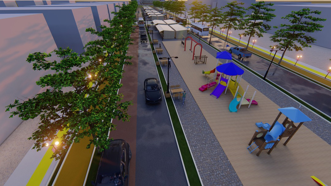
A 15m wide median strip is proposed to be the most active area with a diverse range of uses including open green areas, sit-outs, commercial stalls, outdoor dining, children’s playground, and public presentations. This is expected to increase pedestrian density, promote business activity, and encourage recreation on the street. The on the median strip are also a means of generating revenue for the city and minimising informal street trading. The median strip is bordered by a green street which can accommodate planter boxes to shield the pedestrians from the driveway. It is lit by double-arm streetlights which also lights the driveway.
Driveway
A single lane driveway of 3.5m width is proposed as the main and only drive way on either side of the median strip. The driveway is expected to serve bus traffic mainly, and private car traffic secondarily. This implies that private cars have second right on the driveway and, as such, do not have overtaking privileges. Private car allowance on the driveway is retained for residents whose access roads collect traffic from the selected distributor streets, and to allow for a gentle transition into pedestrianisation for other users.
Parking Lane
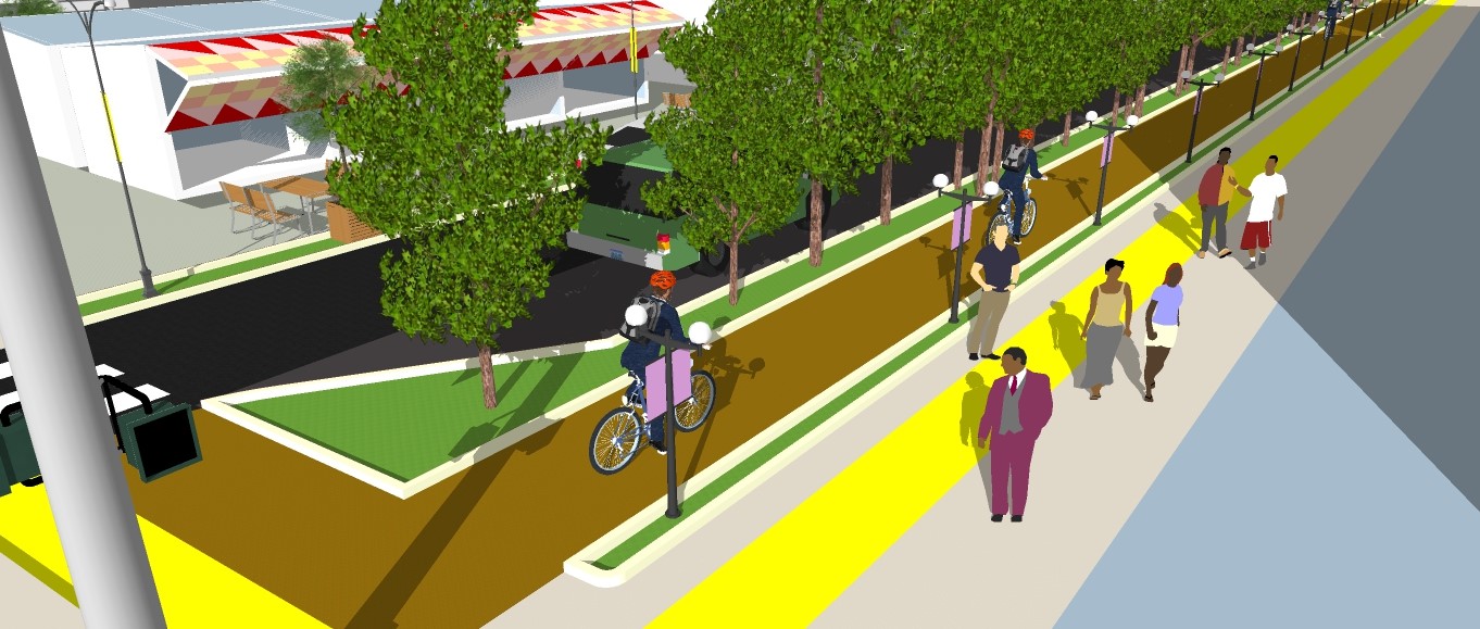
A 2.5m parking land is proposed beside the driveway for parallel parking of private vehicles and bus parking to pick-up and drop-off passengers. The parking lane is flanked by a metre-wide green strip where the street trees are planted. A 3D visualisation of the streetscape showing the median strip, driveway, parking land tree lines is presented below.

Bus Stops
The green strips are proposed to also serve as bus stops before intersections. Simple bus stop shelters are to be provided as buses are expected to run frequently on the road, reducing waiting time for passengers. The shelters are accessible to all road users.

Cycle Lane
A 2m-wide cycle lane is proposed after the green strip to accommodate riders in groups or in both directions. The cycle lane is protected from other traffic by the green strip, and is also shielded by a narrower strip where street lamps are proposed, to also light the sidewalks.
Sidewalk
A 3.5m wide sidewalk is proposed after the cycle lane to promote foot traffic. The sidewalk comprises of metre-wide bright yellow tactile paving for the visually impaired. The sidewalks are not elevated from the driveway to remove the need for ramps while still being accessible to wheelchairs, scooters, and boards. The cycle lane and sidewalk are visualised in Figure 14.

Source: (Author’s Design, 2022).

Source: (Author’s Design, 2022).
Source: (Author’s Design, 2022).
Conclusion and Recommendations
This project has presented a design proposal for the pedestrianisation of selected streets in Wuse II District of Abuja to improve inclusivity and reduce urban crime. It explored the benefits of walkability such as improved local business activity, reduced vehicle emissions, better physical and mental health, and reduced urban crime. Orttung (2019) highlighted the capacity of capital cities to initiate sustainability policies and practices. This project hereby applies his theory to challenge Abuja, the Federal Capital of Nigeria, to implement the first successful highly-walkable commercial street, and take its place alongside successful pedestrianisation of streets from different regions of the world such as Queen Street, Brisbane (Australia), Strøget, Copenhagen (Denmark), Nanjing Street, Shanghai (China) and many more.
For the successful pedestrianisation of the selected streets in Wuse II, the following steps are recommended:
- Public awareness campaigns on the environmental, social, and economic benefits of walking and reducing car dependency, targeting groups such as business owners on the streets and policy makers.
- Community engagement of business owners and residents of Wuse II to present the pedestrianisation plan for public feedback.
- Gentle plan implementation through periodic car regulation on the streets, with on-street activities such as expos, carnivals, exhibitions, and public presentations.
- Complete plan implementation through the development of street infrastructure and fitting of necessary elements (including lighting, signs, and markings) as proposed.
- Facilitating other factors to support walkability with intentional effort towards improving the sustainability of Wuse II such as densification and mixed uses.
- The need for alternative and seamless transport options that can match or surpass the level of convenience the car provides by promoting walkability through the provision of complete streets supported by public transit, cycling, dense housing, and compact land use distribution